GPS Map Camera
A modern GPS Map Camera UI design with built-in templates for different photo styles. It allows users to capture images with real-time location, date, and map stamps, making travel and documentation simple, organized, and visually engaging.
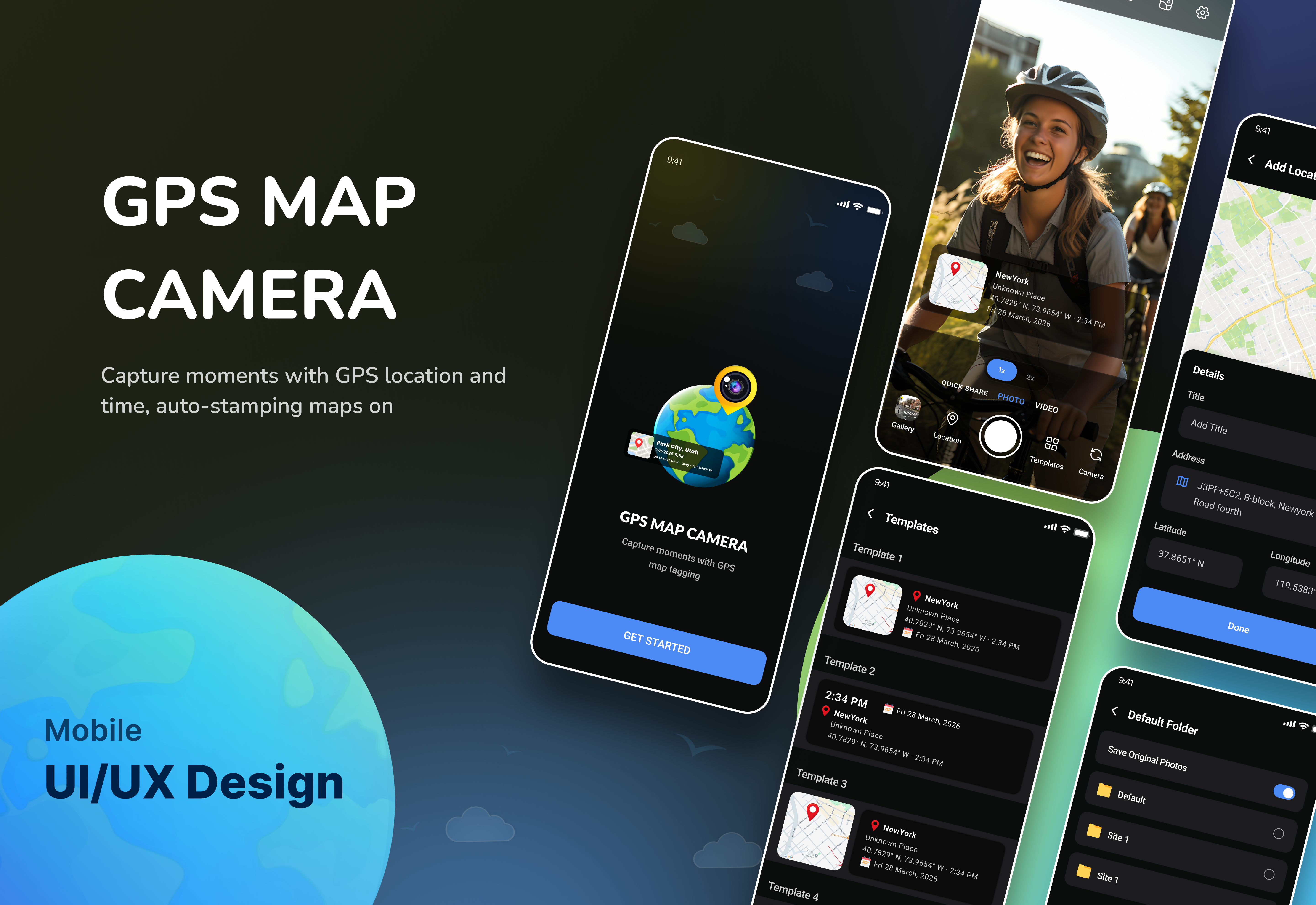
Project Overview
A GPS Map Camera app that enhances your photos with real-time location, date, time, and map stamps. It offers customizable templates and a simple interface, making it perfect for travel, fieldwork, and accurate photo documentation. 📍 Captures photos with real-time GPS location, date, time, and coordinates 🗺️ Automatically stamps map details on every image for accurate documentation 🎨 Offers customizable templates for different photo styles and layouts 📱 Simple and user-friendly interface for quick and easy use 🌍 Ideal for travel, fieldwork, and location-based reporting 🕒 Helps preserve memories with exact place and time information
The Challenge
Many users struggle to prove where and when a photo was taken, especially for travel documentation, field reporting, and project verification. Standard camera apps don’t provide reliable location or time data, making it difficult to organize, authenticate, and present visual evidence. This leads to confusion, lack of trust, and poor record-keeping in both personal and professional use.
Our Solution
Our GPS Map Camera app solves this by automatically adding accurate real-time location, date, time, and map data to every photo. It ensures each image is properly verified and organized, making it easy to track, document, and present reliable visual proof for both personal and professional use.